Choose Which Site You Want To See




Anquet Maps is a digital mapping service that provides tools for planning, viewing, and tracking outdoor routes.
It focuses on helping walkers, hikers, and outdoor enthusiasts explore terrain with detailed map options and straightforward navigation features. The platform may suit individuals looking for digital access to mapping data that can be used across devices. Its tools are designed to support route preparation and on‑the‑go reference, with content that is typically useful for both occasional and regular outdoor activity.
Anquet Maps is a UK-based digital mapping provider offering navigation software, downloadable maps, and route planning tools aimed at walkers, hikers, cyclists, and outdoor enthusiasts. The brand focuses on providing accessible mapping technology that supports recreational and professional users who want detailed geographic information for outdoor planning. With long-standing roots in the digital mapping sector, the company is known for delivering tools built around clarity, usability, and UK terrain coverage.
The service typically positions itself in the mid-market segment. Instead, it offers a practical, feature-focused experience supported by downloadable mapping products, mobile access, and compatibility with a range of UK mapping formats. The emphasis is on utility, route planning convenience, and integration with Ordnance Survey mapping where licensed.
While the full scale of the company’s operations is not publicly detailed, Anquet Maps is recognised for its continuity within the digital mapping space. Its tools cater to users seeking offline or online route exploration, map layering, and spatial data visualisation without the complexity associated with advanced GIS software. It aims to provide a balanced offering: feature-rich enough for regular outdoor users while remaining approachable for beginners.
Readers can expect a structured, map-centred experience that focuses on practical navigation tasks, approachable interfaces, and tools designed to prepare routes at home or on the move. This editorial review explores how the brand positions itself, what it offers, and which types of users may find it relevant for their outdoor planning and navigation needs.
Browse the full range on the Anquet Maps website.
This category includes the core applications that allow users to view maps, create routes, and manage location data. The software typically offers tools for zooming, layering, annotating, and exporting routes, positioning it as a practical solution for recreational outdoor planning.
Many users turn to Anquet Maps for licensed Ordnance Survey layers. These maps provide detailed UK terrain representation, including footpaths, contours, and landmarks. They are suited to walkers and hikers who want reliable depiction of ground features.
The brand offers additional topographic or outdoor-focused mapping where available. These maps generally highlight elevation and landscape features, appealing to users preparing for more involved route planning tasks.
Route creation tools help users mark paths, calculate gradients, and estimate travel distance. They are often used by walkers and cyclists who want a clear overview before setting out.
Some mapping bundles include the option to download maps for offline use. This is especially important for users visiting remote locations where mobile signal cannot be relied upon.
Users often access their maps across desktop and mobile apps. Synchronisation helps maintain consistency when switching between devices during planning and outdoor use.
Certain mapping tools offer 3D or perspective views. These provide a clearer sense of gradient and landform, supporting users who want extra context about elevation changes.
Printable outputs allow users to carry paper versions during trips. This appeals to individuals who want a hybrid approach, using both digital and physical references.
The platform supports GPX file use, which enables data sharing across various navigation devices. This functionality appeals to users who switch between different tools or collaborate with others.
Anquet Maps offers map packages or subscriptions depending on the mapping product. These options help users choose coverage areas suitable for their typical outdoor activities.
Anquet Maps approaches digital mapping with a focus on practicality, terrain accuracy, and consistency across its platforms. Rather than positioning itself as a specialist tool for professional surveying, it prioritises approaches suited to regular walkers, leisure users, and enthusiasts who want trustworthy mapping without steep learning curves.
The brand’s values appear centred on clarity and functionality. It provides structured mapping interfaces designed to help users understand routes and terrain. The platform’s positioning sits between accessible consumer mapping apps and more advanced geospatial systems, serving a market looking for dependable mapping tools without unnecessary complexity.
The usability of Anquet Maps typically reflects a functional, map-first design. Interfaces are built around navigation tasks, with accessible menus and straightforward options for creating and adjusting routes. Users often appreciate the clarity of map layers and the logical layout of tools.
The onboarding experience usually involves installing software or mobile apps and selecting relevant map packages. Information is presented in a structured way, helping users understand how to begin building or importing routes. Offline access, syncing, and map management functions are generally designed to be clear and practical for both new and returning users.
Anquet Maps is known for providing digital mapping tools and route planning features focused on UK outdoor activities. The brand offers access to detailed mapping and aims to help users prepare routes clearly and efficiently. This includes software that supports both online and offline navigation.
The platform operates by offering downloadable and interactive maps through its desktop and mobile applications. Users can view terrain, create routes, and switch between map formats. Its operating model revolves around providing clear mapping tools supported by subscription or package-based access to mapping areas.
The platform is commonly used by walkers, hikers, cyclists, and outdoor enthusiasts who want detailed mapping for UK-based routes. It also attracts beginners who want a structured mapping environment along with users who prefer offline functionality.
It can be suitable for beginners who want a straightforward way to explore maps and build simple routes. The interface focuses on clarity, and features are arranged in a way that supports users who are learning navigation skills.
Anquet Maps offers a map-centric experience that may feel more detail-oriented than general navigation apps. It sits between casual consumer navigation tools and advanced GIS programs, offering flexibility without becoming overly technical.
Users may want to understand which map formats they need and whether offline access matters for their activities. It is also helpful to know that the platform provides tools for route planning and map management rather than acting as a turn-by-turn navigation system.
Anquet Maps offers digital mapping tools and route planning features aimed at walkers, cyclists, and outdoor explorers who want detailed and reliable UK map coverage. Its positioning sits between accessible consumer apps and more advanced mapping systems, making it a practical option for users who value clarity and direct functionality. The range of map types, including options that highlight terrain and footpaths, supports activities where accurate ground-level information is useful.
The brand’s approach focuses on structured, map-first design, with an emphasis on presenting information in ways that are easy to interpret. Offline access, cross-device syncing, and compatibility with standard file formats provide versatility for different types of users.
Overall, the brand maintains a consistent presence in the digital mapping landscape, offering tools designed for route preparation and exploration. Its steady appeal reflects ongoing interest in outdoor navigation solutions that balance usability with detailed mapping coverage.
Ready to shop? See the full range on the Anquet Maps website.
This guide was written by AI. It does not represent the views or opinions of the website owner.
Updated October 2026

Four Os Maps In A Light Oak Frame: Four OS Maps in a Light Oak FrameCentred on your postcode, a collection of Past and Present Ordnance Survey maps from...

Tomtom Start 42 4-inch Sat Nav With European Maps And Lifetime Map Updates: The TomTom START 42 offers essential navigation and free lifetime map updates. Finding destinations is simple from the...

Tomtom Start 62 6-inch Sat Nav With Western Europe Maps And Lifetime Map Updates: The TomTom START 62 offers essential navigation and free lifetime map updates. Finding destinations is simple from the...

Tomtom Start 52 5-inch Sat Nav With Western European Maps And Lifetime Map Updates: The TomTom START 52 offers essential navigation and free lifetime map updates! Finding destinations is simple from the...

Garmin Maps Great Britain & Ireland 2008 (microsd/sd): GPS Maps / Media Type: SD Card / Suitable for: GPS / Maps: Ireland, Great Britain / Plug and Play / Operating System:...

Tomtom Go 6100 6 Inch World Maps Sat Nav With Sim Card And Unlimited Data Included: Lifetime TomTom Traffic via Built-in SIM The SIM card built into the TomTom GO ensures you are always connected to...

Tomtom Go 510 5 Inch Sat Nav With World Maps & Live Traffic: The TomTom GO 510 is our fully interactive GO model with Lifetime TomTom Services including map updates at no extra...

Ign Maps \'top 100\' Series: 166 Pau / Bayonne Folded Map: IGN Top 100 road maps of France are exceptionally detailed, contoured road maps, ideal for exploring the French...

Ign Maps \'top 100\' Series: 190 Paris/chantilly/fontainebleau Folded Map: IGN Top 100 road maps of France are exceptionally detailed, contoured road maps, ideal for exploring the French...

Ign Maps \'top 100\' Series: 156 Le Puy-en-velay / Privas Folded Map: IGN Top 100 road maps of France are exceptionally detailed, contoured road maps, ideal for exploring the French...

Ign Maps \'top 100\' Series: 136 Dijon / Chalons-sur-saone Folded Map: IGN Top 100 road maps of France are exceptionally detailed, contoured road maps, ideal for exploring the French...

Ign Maps \'top 100\' Series: 157 Grenoble / Montelimar Folded Map: IGN Top 100 road maps of France are exceptionally detailed, contoured road maps, ideal for exploring the French...

Ign Maps \'top 100\' Series: 162 Rodez / Millau Folded Map: IGN Top 100 road maps of France are exceptionally detailed, contoured road maps, ideal for exploring the French...

Ign Maps \'top 100\' Series: 147 Limoges / Gueret Folded Map: IGN Top 100 road maps of France are exceptionally detailed, contoured road maps, ideal for exploring the French...

Ign Maps \'top 100\' Series: 141 Moulins / Vichy Folded Map: IGN Top 100 road maps of France are exceptionally detailed, contoured road maps, ideal for exploring the French...

Ign Maps \'top 100\' Series: 118 Paris / Chartres Folded Map: IGN Top 100 road maps of France are exceptionally detailed, contoured road maps, ideal for exploring the French...
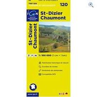
Ign Maps \'top 100\' Series: 120 St-dizier / Chaumont Folded Map: IGN Top 100 road maps of France are exceptionally detailed, contoured road maps, ideal for exploring the French...

Ign Maps \'top 100\' Series: 130 Vesoul / Langres Folded Map: IGN Top 100 road maps of France are exceptionally detailed, contoured road maps, ideal for exploring the French...

Ign Maps \'top 100\' Series: 137 Besancon / Montbeliard Folded Map: IGN Top 100 road maps of France are exceptionally detailed, contoured road maps, ideal for exploring the French...

Ign Maps \'top 100\' Series: 117 Caen / Evreux Folded Map: IGN Top 100 road maps of France are exceptionally detailed, contoured road maps, ideal for exploring the French...
 All Trails
 Sleepiest
 I Fax App
 Paired
 My Heritage
 Opera
 My First Five Years
 Money Masters App
 My Day
 We Are 8