Choose Which Site You Want To See



Get Mapping provides aerial imagery, mapping data and geospatial services.
Its range includes vertical and infrared imagery, historical content, planning maps and height datasets.
Get Mapping provides aerial imagery, mapping data and geospatial services. Its content includes vertical aerial photography, height data and historical imagery.
The range also includes planning maps, mapping datasets, mobile mapping and data visualisation. Content can be accessed through online tools, downloads and streaming services.
Get Mapping offers aerial imagery alongside terrain models, contours, address data and other mapping content. Its services include street scanning, consultancy and web-based access to geospatial data.
The merchant also offers subscriptions and bespoke data solutions. Data is licensed, with options based on how it will be used.
Vertical imagery is captured from a straight-down perspective using a camera mounted underneath an aircraft. The imagery is orthorectified using height and GPS data. Get Mapping lists resolutions from 5cm to 25cm. Its historical archive also includes vertical imagery.
Get Mapping provides near-infrared aerial imagery as well as vertical imagery. Its infrared content captures reflected wavelengths and is recorded at the same time as vertical aerial imagery. The page names land classification and agricultural analysis among its applications.
The historic imagery archive contains aerial mapping content from different years. It is available as a time series through hosting and streaming services. The site describes uses including historical comparisons and reviewing past conditions.
Height datasets are derived from aerial photography. Digital terrain models represent bare earth with buildings and vegetation removed, while digital surface models include visible features such as buildings and trees. The range also includes contours, spot heights and canopy height models.
Get Mapping offers mapping datasets from Ordnance Survey, including imagery, roads, water networks and open-space layers. Address data uses coordinates to identify addresses. Other mapping content includes electoral and administrative boundaries, postcode polygons and vector data.
MapShop offers customisable planning maps alongside aerial photography. The maps are described for planning applications and site assessments. Shoppers can choose the area they need and download the data.
The merchant offers Survey as a Service through mobile mapping. This involves scanning streets and sites from a moving vehicle and capturing 3D data. Mobile mapping outputs are also available through the Soarvo workspace.
Get Mapping offers access to aerial imagery and mobile mapping data through the cloud-based Soarvo workspace. Users can upload and manage their own survey files, visualise data in 3D, annotate and measure. The platform also has collaboration and sharing tools, plus a mobile app that can sync data with a project workspace.
Browse the full range on the Get Mapping website.
The site names Ordnance Survey mapping data and the Soarvo data visualisation platform.
MapShop lets shoppers select an area and download aerial imagery or planning maps. The site also has a help desk for MapShop questions and a chatbot for queries about MapShop or planning maps.
There are case studies and articles about geospatial data, along with a calendar for scheduling a call. The site also offers a newsletter.
Geospatial content can be streamed through WMS feeds or accessed by direct download. API integration is also offered for aerial imagery and mobile mapping data.
Supported formats listed on the site include ECW, JPEG2000 and GeoTIFF. LAS/LAZ is listed for point clouds, and DXF/DWG for contours. The merchant also offers onboarding support and bespoke data solutions.
Resolution refers to Ground Sample Distance, or the size of one pixel on the ground. At 5cm Ground Sample Distance, each pixel represents 5cm.
Get Mapping lists vertical and infrared aerial imagery. It also offers height data and historical aerial imagery.
The merchant offers streaming through WMS feeds and direct downloads. Subscriptions are also available.
Yes. Get Mapping says its data is licensed, with licensing options based on the intended use.
A digital terrain model represents bare earth with buildings and vegetation removed. A digital surface model includes visible features such as buildings and trees.
Users can stream imagery and mobile mapping data, and upload their own survey files. The workspace also offers 3D visualisation, annotation, measurement and collaboration tools.
Get Mapping brings together aerial imagery, height data, planning maps and mapping datasets with mobile mapping and visualisation services. Shoppers can explore individual areas through MapShop or consider streaming and other data access options for their projects.
Ready to shop? See the full range on the Get Mapping website.
This guide was written by AI. It does not represent the views or opinions of the website owner.
Updated November 2026
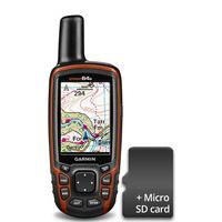
Garmin Gpsmap 64s Gps Bundle With Gb Discoverer Mapping 1:50k - Full Country: The GPSMAP« 64s has all the features of the GPSMAP 64, with the added inclusion of a barometric altimeter, 3-axis compass and wireless connectivity. This bundle includes Garmin GB Discovererà 1:50k OS Landranger mapping for the whole of Great Britain.

Lezyne Super Cycle Gps With Mapping Gps Cycle Computers: You, your Phone and Lezyne GPS: The Cycling Trinity. Lezyne's brand new GPS range now works in harmony with your Smartphone, making it the ultimate cycling device. Use mapping from the Lezyne GPS Root website to follow a route, tackle Strava KOMs and QOMs with the Live Segments feature and stay connected with phone notifications direct to your GPS unit. These feature-rich GPS computers now have enhanced accuracy with an internal accelerometer to give you the best possible data about your...

Lezyne Micro Colour Cycle Gps With Mapping Gps Cycle Computers: You, your Phone and Lezyne GPS: The Cycling Trinity. Lezyne's brand new GPS range now works in harmony with your Smartphone, making it the ultimate cycling device. Use mapping from the Lezyne GPS Root website to follow a route, tackle Strava KOMs and QOMs with the Live Segments feature and stay connected with phone notifications direct to your GPS unit. These feature-rich GPS computers now have enhanced accuracy with an internal accelerometer to give you the best possible data about your...
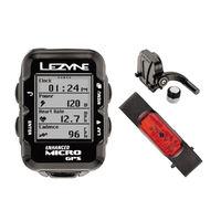
Lezyne Micro Cycle Gps With Mapping Hrsc Loaded Gps Cycle Computers: You, your Phone and Lezyne GPS: The Cycling Trinity. Lezyne's brand new GPS range now works in harmony with your Smartphone, making it the ultimate cycling device. Use mapping from the Lezyne GPS Root website to follow a route, tackle Strava KOMs and QOMs with the Live Segments feature and stay connected with phone notifications direct to your GPS unit. These feature-rich GPS computers now have enhanced accuracy with an internal accelerometer to give you the best possible data about your...

Lezyne Micro Colour Cycle Gps With Mapping Hrsc Loaded Gps Cycle Computers: You, your Phone and Lezyne GPS: The Cycling Trinity. Lezyne's brand new GPS range now works in harmony with your Smartphone, making it the ultimate cycling device. Use mapping from the Lezyne GPS Root website to follow a route, tackle Strava KOMs and QOMs with the Live Segments feature and stay connected with phone notifications direct to your GPS unit. These feature-rich GPS computers now have enhanced accuracy with an internal accelerometer to give you the best possible data about your...

Lezyne Mini Cycle Gps With Mapping Gps Cycle Computers: You, your Phone and Lezyne GPS: The Cycling Trinity. Lezyne's brand new GPS range now works in harmony with your Smartphone, making it the ultimate cycling device. Use mapping from the Lezyne GPS Root website to follow a route, tackle Strava KOMs and QOMs with the Live Segments feature and stay connected with phone notifications direct to your GPS unit. These feature-rich GPS computers now have enhanced accuracy with an internal accelerometer to give you the best possible data about your...

Lezyne Micro Cycle Gps With Mapping Gps Cycle Computers: You, your Phone and Lezyne GPS: The Cycling Trinity. Lezyne's brand new GPS range now works in harmony with your Smartphone, making it the ultimate cycling device. Use mapping from the Lezyne GPS Root website to follow a route, tackle Strava KOMs and QOMs with the Live Segments feature and stay connected with phone notifications direct to your GPS unit. These feature-rich GPS computers now have enhanced accuracy with an internal accelerometer to give you the best possible data about your...

Lezyne Super Cycle Gps With Mapping Hrcs Loaded Gps Cycle Computers: You, your Phone and Lezyne GPS: The Cycling Trinity. Lezyne's brand new GPS range now works in harmony with your Smartphone, making it the ultimate cycling device. Use mapping from the Lezyne GPS Root website to follow a route, tackle Strava KOMs and QOMs with the Live Segments feature and stay connected with phone notifications direct to your GPS unit. These feature-rich GPS computers now have enhanced accuracy with an internal accelerometer to give you the best possible data about your...

Lezyne Macro Cycle Gps With Mapping Loaded Bundle Gps Cycle Computers: You, your Phone and Lezyne GPS: The Cycling Trinity. Lezyne's brand new GPS range now works in harmony with your Smartphone, making it the ultimate cycling device. Use mapping from the Lezyne GPS Root website to follow a route, tackle Strava KOMs and QOMs with the Live Segments feature and stay connected with phone notifications direct to your GPS unit. These feature-rich GPS computers now have enhanced accuracy with an internal accelerometer to give you the best possible data about your...
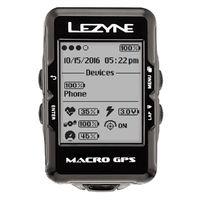
Lezyne Macro Cycle Gps With Mapping Gps Cycle Computers: You, your Phone and Lezyne GPS: The Cycling Trinity. Lezyne\'s brand new GPS range now works in harmony with your Smartphone, making it the ultimate cycling device. Use mapping from the Lezyne GPS Root website to follow a route, tackle Strava KOMs and QOMs with the Live Segments feature and stay connected with phone notifications direct to your GPS unit. These feature-rich GPS computers now have enhanced accuracy with an internal accelerometer to give you the best possible data about your ride...

Full Body Mole Mapping: Mole Mapping: Nuriss offers the most Advanced Automated Total Body Photography and Dermoscopy system- with our lead Doctor, Dr Anita Sturnham. The perfect way to keep your skin safe and to screen for skin cancer Moles are common. They are a collection of cells in the skin and can be brown, skin coloured, flat, raised, hairy all depending on the type of mole it is. They tend to slowly change in appearance as the skin ages and you may notice over the years that they change in size, shape...

Face Mapping: Our qualified therapists will use Dermalogica's face mapping to provide a deep look into your skin's health. They will analyse the 14 zones on the face, neck & chest and will recommend treatments specifically designed to address your personal skin concerns

Dermalogica Face Mapping Analysis System Incl. Pressure Point Massage: You will enjoy: Dermalogica face mapping analysis system Pressure point massage

Dermalogica Face Mapping Analysis System: You will enjoy: Dermalogica face mapping analysis system

Facial And Face Mapping: You will enjoy: Facial Face mapping

Joseph Gillot Mapping Pen Set: A specialist fine artist\'s pen for mapping work. Provides exceptionally fine detail. Supplied with 6 nibs of one type and an ergonomic handle. Please note: these nibs are only compatible with this special handle.

Keep Calm Get Well | Personalised Get Well Card: Keep Calm Get Well | Personalised Get Well Card. Of course you\'ll get better immediately with these personalised get well cards, an excellent reason to get out of bed!

Get Well Star | Personalised Get Well Card: get well star | personalised get well card - This bright and simple typographic card is perfect sending your get well wishes. One of our cheery personalised get well cards.

Mio Skincare Get Waisted Body Cream (100ml): Get Waisted can help improve the appearance and elasticity of your skin. When exercise alone wonât give you the tummy you want, Get Waisted! Helps promote the elasticity and moisture of your skin so it feels smooth and taut How it works Get Waisted works by enhancing the look of your skin. Get Waisted has 7 ingredients that are designed to help skin look firmer and tighter. We want to be totally realistic on this - it is not going to remove large fat deposits. That takes a combination of...

Patrick Holford Get Up & Go 300g (1 X 300g): Patrick Holford - Get Up and Go (300g) Get Up and Go! is a delicious low GL breakfast shake powder which is ideal for use in a healthy shake or smoothie. Get Up and Go! provides a wide range of vitamins and minerals, protein, essential fatty acids combined with a blend of wholefoods. Recommended Intake Five level dessertspoons (30g) of Get Up and Go! daily with half a pint of milk, soya milk or rice milk, and a banana or other fruit Ingredients: Soy isolate1 (non-GMO), apple powder, xylitol,...
 Mafett
 Surface View
 Media Storehouse
 Glamour Mirrors - Hollywood Mirrors
 Blim & Blum
 Fy
 Art Republic
 Green Lili
 Cox & Cox